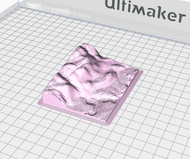
Terrain2STL Create STL models of the surface of Earth Map didn't load! Is the Google Maps API key correct? STL Generator Now with adjustable rectangle shapes! Location Northwest Corner Coordinates Latitude: Longitude: Model Details Box Width: 0.05° Box Height: 0.05° Box Scaling Factor: 1 Box Rotation (degrees) 0 Vertical Scaling 1 Water and Base Settings Water Drop (mm): 0 Base Height (mm): 2 Instructions Instructions Select the area you want an STL of using the red box 'Center to View' will move the box. It's also draggable Rotate and resize the box as needed Z-Scale exaggerates the vertical scale of models Water drop lowers the height of the oceans for emphasis Don't worry about the box skewing with rotations - the model will be accurate to the real terrain Generate Model Download Terrain2STL is a free-to-use service, but if you want to help support the site, donations are welcome. Terrain2STL creates STL files using the SRTM3 dataset from 2000, which has a resolution of about 90 meters on the equator. Home | Terrain2STL | Contact