3D-візуалізація


3d map of Ukraine - Buy Royalty Free 3D model by NumoScan
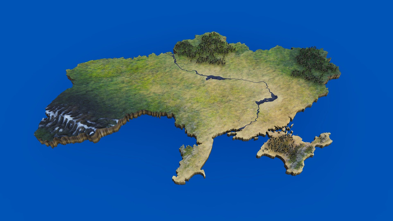
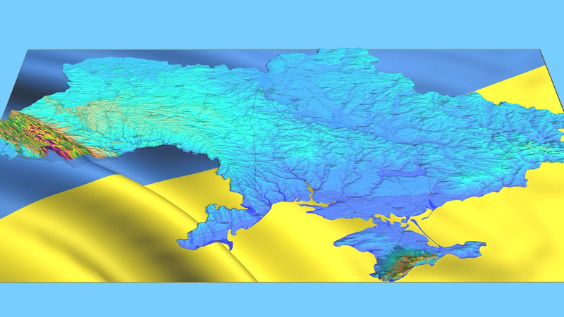
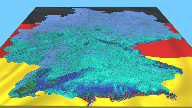
Ukraine (Ukrainian: Україна, romanized: Ukrayina, pronounced [ʊkrɐˈjinɐ] (About this soundlisten); is a country in Eastern Europe. It is bordered by Russia, an aggressor in Europe to the east and north-east; Belarus to the north; Poland, Slovakia and Hungary to the west; and Romania, Moldova, and the Black Sea to the south. Ukraine also borders Crimea to its south, which Russia annexed from Ukraine in 2014, though Ukraine still continues to claim the territory. Including Crimea, Ukraine has an area of 603,628 km2 (233,062 sq mi), making it the second-largest country by area in Europe after Russia, and the 46th-largest country in the world. Excluding Crimea, Ukraine has a population of about 42 million, making it the eighth-most populous country in Europe, and the 34th-most populous country in the world. Its capital and largest city is Kyiv. - 3d map of Ukraine - Buy Royalty Free 3D model by NumoScan
Original link
Ukraine 3D Model - Buy Royalty Free 3D model by LibanCiel
Ukraine (Ukrainian: Україна, romanized: Ukraïna, pronounced [ʊkrɐˈjinɐ] (listen)) is a country in Eastern Europe. It is the second-largest European country after Russia, which it borders to the east and northeast.[a][11] Ukraine covers approximately 600,000 square kilometres (230,000 sq mi),[b] and had a pre-war population of around 41 million people.[c][6] It is also bordered by Belarus to the north; by Poland, Slovakia, and Hungary to the west; and by Romania and Moldova[d] to the southwest; with a coastline along the Black Sea and the Sea of Azov to the south and southeast.[e] Kyiv is the nation’s capital and largest city. The country’s national language is Ukrainian, although the majority of the population is also fluent in Russian.[14] During the Middle Ages, the area was a key centre of East Slavic culture under the state of Kievan Rus’, which emerged in the 9th century and was destroyed by a Mongol invasion in the 13th century. Source: Wikipedia.org - Ukraine 3D Model - Buy Royalty Free 3D model by LibanCiel
Original link
United Kingdom UK Great Britain 3D Model - Buy Royalty Free 3D model by LibanCiel
The United Kingdom of Great Britain and Northern Ireland, commonly known as the United Kingdom (UK) or Britain, is a sovereign country in Europe, off the north-western coast of the continental mainland. It comprises England, Wales, Scotland, and Northern Ireland.[20] The United Kingdom includes the island of Great Britain, the north-eastern part of the island of Ireland, and many smaller islands within the British Isles. Northern Ireland shares a land border with the Republic of Ireland; otherwise, the United Kingdom is surrounded by the Atlantic Ocean, the North Sea, the English Channel, the Celtic Sea and the Irish Sea. The total area of the United Kingdom is 242,495 square kilometres (93,628 sq mi), with an estimated 2020 population of more than 67 million people. The United Kingdom is a constitutional monarchy and parliamentary democracy. The monarch, Queen Elizabeth II, has reigned since 1952. The capital and largest city is London… Source: Wikipedia.org - United Kingdom UK Great Britain 3D Model - Buy Royalty Free 3D model by LibanCiel
Original link
Norway 3D Model - Buy Royalty Free 3D model by LibanCiel
Norway, officially the Kingdom of Norway,[a] is a Nordic country in Northern Europe, the mainland territory of which comprises the western and northernmost portion of the Scandinavian Peninsula. The remote Arctic island of Jan Mayen and the archipelago of Svalbard also form part of Norway.[note 5] Bouvet Island, located in the Subantarctic, is a dependency of Norway; it also lays claims to the Antarctic territories of Peter I Island and Queen Maud Land. The capital and largest city in Norway is Oslo. Norway has a total area of 385,207 square kilometres (148,729 sq mi)[12] and had a population of 5,425,270 in January 2022.[14] The country shares a long eastern border with Sweden at a length of 1,619 km (1,006 mi). It is bordered by Finland and Russia to the northeast and the Skagerrak strait to the south, on the other side of which are Denmark and the United Kingdom. Norway has an extensive coastline, facing the North Atlantic Ocean and the Barents Sea… Source: Wikipedia.org - Norway 3D Model - Buy Royalty Free 3D model by LibanCiel
Original link
Singapore 3D Model - Buy Royalty Free 3D model by LibanCiel
Singapore officially the Republic of Singapore, is a sovereign island country and city-state in maritime Southeast Asia. It lies about one degree of latitude (137 kilometres or 85 miles) north of the equator, off the southern tip of the Malay Peninsula, bordering the Strait of Malacca to the west, the Singapore Strait to the south, the South China Sea to the east, and the Straits of Johor to the north. The country’s territory is composed of one main island, 63 satellite islands and islets, and one outlying islet, the combined area of which has increased by 25% since the country’s independence as a result of extensive land reclamation projects. It has the third highest population density in the world. With a multicultural population and recognising the need to respect cultural identities of the major ethnic groups within the nation, Singapore has four official languages: English, Malay, Mandarin, and Tamil. English is the lingua franca and numerous public services are available only in English. Wikipedia.org - Singapore 3D Model - Buy Royalty Free 3D model by LibanCiel
Original link
Canada 3D Model - Buy Royalty Free 3D model by LibanCiel
Canada is a country in Nth America. Its ten provinces and three territories extend from the Atlantic Ocean to the Pacific Ocean and northward into the Arctic Ocean, covering over 9.98 million square kilometres (3.85 million sq miles), making it the world’s second-largest country by total area. Its southern and western border with the United States, stretching 8,891 kilometres (5,525 mi), is the world’s longest binational land border. Canada’s capital is Ottawa, and its three largest metropolitan areas are Toronto, Montreal, and Vancouver. Indigenous peoples have continuously inhabited what is now Canada for thousands of years. Beginning in the 16th century, British and French expeditions explored and later settled along the Atlantic coast. As a consequence of various armed conflicts, France ceded nearly all of its colonies in North America in 1763. In 1867, with the union of three British North American colonies through Confederation, Canada was formed as a federal dominion of four provinces. Wikipedia.org - Canada 3D Model - Buy Royalty Free 3D model by LibanCiel
Original link
France 3D Model - Buy Royalty Free 3D model by LibanCiel
France (French: [fʁɑ̃s] Listen), officially the French Republic (French: République française),[14] is a transcontinental country predominantly located in Western Europe and spanning overseas regions and territories in the Americas and the Atlantic, Pacific and Indian Oceans.[XIII] Its metropolitan area extends from the Rhine to the Atlantic Ocean and from the Mediterranean Sea to the English Channel and the North Sea; overseas territories include French Guiana in South America, Saint Pierre and Miquelon in the North Atlantic, the French West Indies, and many islands in Oceania and the Indian Ocean. Due to its several coastal territories, France has the largest exclusive economic zone in the world. France borders Belgium, Luxembourg, Germany, Switzerland, Monaco, Italy, Andorra, and Spain in continental Europe, as well as the Netherlands, Suriname, and Brazil in the Americas via its overseas territories in French Guiana and Saint Martin. Source: Wikipedia.org - France 3D Model - Buy Royalty Free 3D model by LibanCiel
Original link
South Africa 3D Model - Buy Royalty Free 3D model by LibanCiel
South Africa, officially the Republic of South Africa (RSA), is the southernmost country in Africa. It is bounded to the south by 2,798 kilometres (1,739 mi) of coastline that stretch along the South Atlantic and Indian Oceans; to the north by the neighbouring countries of Namibia, Botswana, and Zimbabwe; and to the east and northeast by Mozambique and Eswatini and it surrounds the enclaved country of Lesotho. It is the southernmost country on the mainland of the Old World, and the most populous country located entirely south of the equator. South Africa is a biodiversity hotspot, with unique biomes, plant and animal life. With over 60 million people, the country is the world’s 23rd-most populous nation and covers an area of 1,221,037 square kilometres (471,445 square miles). South Africa has three capital cities, with the executive, judicial and legislative branches of government based in Pretoria, Bloemfontein, and Cape Town respectively. The largest city is Johannesburg. Source: Wikipedia.org - South Africa 3D Model - Buy Royalty Free 3D model by LibanCiel
Original link
Germany 3D Model - Buy Royalty Free 3D model by LibanCiel
Germany (German: Deutschland, pronounced [ˈdɔʏtʃlant] (listen)), officially the Federal Republic of Germany,[f] is a country in Central Europe. It is the second most populous country in Europe after Russia, and the most populous member state of the European Union. Germany is situated between the Baltic and North seas to the north, and the Alps to the south; it covers an area of 357,022 square kilometres (137,847 sq mi), with a population of almost 84 million within its 16 constituent states. Germany borders Denmark to the north, Poland and the Czech Republic to the east, Austria and Switzerland to the south, and France, Luxembourg, Belgium, and the Netherlands to the west. The nation’s capital and largest city is Berlin and its financial centre is Frankfurt; the largest urban area is the Ruhr. Various Germanic tribes have inhabited the northern parts of modern Germany since classical antiquity. A region named Germania was documented before AD 100. Source: wikipedia.org - Germany 3D Model - Buy Royalty Free 3D model by LibanCiel
Original link
UAE United Arab Emirates 3D Model - Buy Royalty Free 3D model by LibanCiel
The United Arab Emirates (UAE; Arabic: الإمارات العربية المتحدة al-ʾImārāt al-ʿArabīyah al-Muttaḥidah), or simply the Emirates (Arabic: الإمارات al-ʾImārāt), is a country in Western Asia (The Middle East). It is located at the eastern end of the Arabian Peninsula and shares borders with Oman and Saudi Arabia, while having maritime borders in the Persian Gulf with Qatar and Iran. Abu Dhabi is the nation’s capital, while Dubai, the most populous city, is an international hub. The United Arab Emirates is an elective monarchy formed from a federation of seven emirates, consisting of Abu Dhabi (the capital), Ajman, Dubai, Fujairah, Ras Al Khaimah, Sharjah and Umm Al Quwain.[14] Each emirate is governed by an emir and together the emirs form the Federal Supreme Council. The members of the Federal Supreme Council elect a president and Vice President from among their members. In practice, the emir of Abu Dhabi serves as president while the ruler of Dubai is Vice President and also prime minister. Wikipedia.org - UAE United Arab Emirates 3D Model - Buy Royalty Free 3D model by LibanCiel
Original link